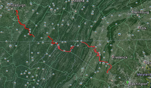
via Bicycle.
 | Pittsburgh to Washington DC via Bicycle. |
| Date | Start | Via | End | Mileage |
| August 4 | Boston | Connellsville, Ohiopyle | Confluence | 67.6 |
| August 5 | Confluence | Rockwood, Myersdale | Cumberland | 32.9 |
| August 6 | Cumberland | Paw Paw Tunnel | Hancock | 44.0 |
| August 7 | Hancock | Ft. Frederick, Antietam | Shepherdstown | 60.2 |
| August 8 | Shepherdstown | Harpers Ferry, Brunswick | Leesburg | 45.7 |
| August 9 | Leesburg | Great Falls, Fletcher's Boat House | Washington | 13.1 |
| Total | 263.5 |
 This trip was from a repeated desire of our friends, Jim and
Sonya, to ride the entire GAP and C&O Canal trails that start in Pittsburgh
and end in Washington DC. After about 6 years of doing long weekends in
Confluence to ride the GAP trail I learned to enjoy the GAP trial with its nearly
continuous canopy and beautiful scenery. Although not a big fan of packed stone
trials I learned to be more accepting of the GAP trial from these trips.
 The
C&O trial turned out to be a different story.
In the early morning Kathie and I packed up our rental car
with our hybrid tandem and luggage for the week and drove to Western
Pennsylvania. At about 10:00 we arrived at Jim and Sonya’s house where we
caught up a bit, then Jim lent us his car so that Kathie could follow me to the
car rental return. We dropped off the rental car then found a wine store to
pick up a few bottles for our trip and picked up some groceries also. We
grabbed some lunch and returned to Jim and Sonya’s.
After visiting for a while, Paul and Jody (our third tandem
couple) arrived. After talking with Paul and Jody for a while Jim and I drove
to the airport to pick up our forth tandem couple (Bob and Kay) at the airport.
We returned to Jim and Sonya’s where they put on a great
dinner for the group. After dinner and
more visiting we all retired for the night.
Day 1 - Boston to Confluence | PICS | MAP
On Sunday morning we got up and had breakfast at the Jim and
Sonya’s and loaded our bikes and luggage into our sag vehicle and an extra
truck. Jim’s son, Mike came to help chauffeur our bikes to the starting point in
Boston, PA. After unloading the bikes and getting a few starting pictures we
were on our way. Bob and Kay were driving SAG and the rest of the party was
pedaling east.
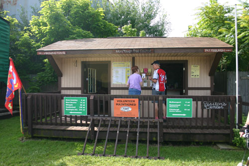 Our first section started in Boston and ended in
Connellsville. Along the way we traveled through several small western
Pennsylvania towns including West Newton.
We stopped to take in the train station in West Newton and to check out
the Layton Tunnel. When I first saw the tunnel and bridge that fed into it, I
thought this was an abandoned tunnel. The bridge was very rusty and didn’t
look very trustworthy. Much to my surprise we started hearing cars crossing the
bridge and into the tunnel.
We soon arrived in Connellsville where Bob and Kay had
parked the SAG vehicle along the trail. We looked for a place to eat and found
Peanut’s Pizza where we ordered sandwiches and returned to a park on the trail
to eat lunch. While waiting for lunch to
be prepared we visited the bike shop across the street.
The next section of our ride ended in Confluence. Jim and
Sonya and Kathie and I were familiar with this section of the trail so Jim and
Sonya drove the SAG to Confluence. On the way we stopped to take in the
beautiful forest and river scenery along the way. One stop was Big Bend which
was a small curve in the trail that exposed a great view of the river valley
below. Here we always take group pictures. Not too long after Big Bend we
started getting close to Ohiopyle which is a very popular town on the trail.
The closer we got to the town the more congested to trail got with tourists.
There were many families biking and hiking the trail. Luckily we got through
the crowds and Bob and Kay and Kathie and I stopped in Ohiopyle for Ice Cream.
We finished our day at the Parker House in Confluence. This
is where we stayed for our long weekends and it has become a favorite place to
stay. Upon arriving we were met by Mary, who owns and runs the Parker house. We
noticed a new bike storage shed behind the house and several other updates
since our last visit. Mary asked us if
we had picked up a fifth couple. It seems that someone called late for a room
and she asked if they were part of our group. The man said yes, we think to
make sure he didn’t get left out of a room. As it turned out that the couple were
a father and daughter (Mark and Erin) that were doing the entire trail as a
summer adventure. They were from the North Hills in PA and headed toward
Sterling in VA. One town a few towns from Jim and Sonya and the other a few towns from Kathie and me.
Mark and Erin were one of three or four groups that we kept
meeting along our trip. This was part of the fun of the trip, repeatedly
running into others taking the trip.
After settling in Jim went to the local barbecue joint for
our dinner. We all enjoyed our dinner and time together at the Parker House,
then retired for our night’s sleep.
Day 2 - Confluence to Cumberland | PICS | MAP
One of my favorite parts of staying at the Parker House is
having breakfast at the Sisters Café. This is a diner that is a throwback to
times forgotten. Big portions of great breakfast fare at a good price. We all
arrived and discovered the "locals" table was empty. The locals usually fill up
the table on weekends. This includes Brad who runs the Confluence Cyclery. We
were told (by Jim) that the locals wouldn’t be in on Monday so took their
table. Later Brad and a few others locals walked in and looked somewhat
disappointed that we took their spot.
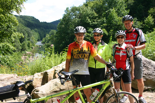 The Sisters Café makes great pancakes that are intimidating
because of their size. They truly fill up a dinner plate. A standard order comes
with 2 pancakes, so I talked Kathie into sharing a plate with me. When the
order came she only took a few bites and I was left eating the rest. We all
enjoyed breakfast and headed back to the parker house to pack, settle our bills
and started our way to Cumberland.
Kathie and I chose to SAG the first section of the day for
two reasons. One, we had ridden this section several times before and two, the
section included the Salisbury viaduct which is a long converted train trestle
over a wide valley just west of Meyersdale that caused me to freeze in panic
last year. There just seems to be something about the bridge the sets off my
fear of heights.
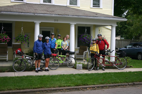
Before we left the Parker House we got to meet
Mark and Erin then Mary’s husband took a picture of the whole group in
front of the house.
Kathie and I started our drive. The GPS route to Meyersdale took us
through
Rockwood, another trail head on the trail. So we stopped to try and get
fixings
for sandwiches so that we could use up
the left over barbecue from the night before for lunch.
We then went to the trail head where we stopped at the bike store on the
trail. The store owner was working in the back and sent someone around to see
if we needed anything. The guy let us in to browse and we then waited on the
trail for the other riders to arrive.
While waiting a couple came through going west and talked to
us while they were taking a rest. They were from Hagerstown, MD and were letting us
know what the C&O trail had in store for us. Soon our group showed up. They
stopped to rest and talk and Mark and Erin caught up with us again.
We finished visiting and started to Meyersdale again. On the
way we ended up driving underneath the Salisbury viaduct and I had to stop to
catch pictures from a safer vantage point. Then we finished the drive into
Meyersdale and found the parking at the train station next to the trail. Across
the street from the station was a new sandwich shop where we ordered sandwiches
for some of our riders who wanted something other than barbecue for lunch. We then found picnic tables near the train station
and set up for lunch.
The train station has a great gift shop, miniature
railroad,
and local museum. Outside was a caboose on display. Soon all parties
arrived
and we had lunch and toured to station. This was also the point where
Kathie and I started riding and Paul and Jodi took over the SAG duties.
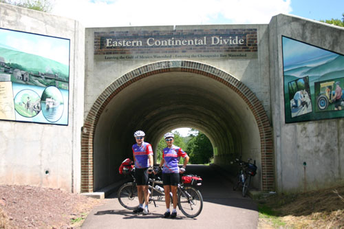 The next section of our ride took us to Cumberland, MD. On
the way we would be crossing the Eastern Continental Divide. This sounds like a
big climb but the trail rarely exceeds a 1.5% elevation grade and makes for an
easy ride. As we approached the divide we saw Paul and Jody walking toward it
after having stopped at a trail head about a half a mile before the divide.
They decided that their adventure would sound a lot better if the said that
they walked up the Continental Divide.
The riders got to the top ahead of the walkers and we
explored and took pictures at the underpass under the road that followed the
ridge that defined the divide. Soon we were all together and took some more
pictures and then went on our way.
On the way down the trail had several tunnels. The first was
just a short distance before the Mason Dixon line which is the border between
Maryland and Pennsylvania. This was the Savage Tunnel, the longest of the
tunnels on the GAP trail. Even with flash lights, these tunnels can be a bit
scary. You can see the other end but it is sometimes hard to know that you are
square on the trail. We survived the tunnel to be greeted with a beautiful
vista looking out into the valley.
We crossed the Mason Dixon line, got through the other
tunnels and were soon on the section of the trail from Frostburg to Cumberland.
This was unique because it was paralleled by a working train track. We didn’t get
to see any trains running on our ride but knew we were close to finishing our
ride for the day.
Our lodging for the night was the Fairfield Inn that sat right
on the trail. We parked our bikes, checked in and got ready for dinner. We found most of the places in town to be
closed on Mondays but we found J&J Pizza and Pub that fit the bill for this
nights dining. After dinner we walked back the hotel and
settled down for our next day of riding.
Day 3 - Cumberland to Hancock | PICS | MAP
On Tuesday, we got up to breakfast at the Fairfield and
started on our first day of riding on the C&O Canal. We decided that
dividing the SAG 4 ways might work out better as this would be a longer day of
riding against a rougher surface on the C&O canal that would probably slow
us down a bit. Bob and Kay picked up the first SAG for the day.
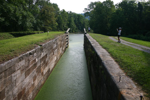
The first thing that slowed us down on the ride was the
introduction of locks on the trail. This wasn’t an obstacle as much as it was a
photo opportunity. We stopped at the
first few then started to realize that these were all too common and looked
much the same.
 Jim and Sonya picked up the second SAG that would finish just short
of the entrance to the Paw Paw tunnel. When we got to the trail head the Orr’s
had sandwiches waiting for us for lunch.
This was a nice park and we had a great lunch. After lunch all 4 teams headed for the Paw
Paw tunnel. This is the longest tunnel on both trails and was unique because it
was a canal trail tunnel. This means that the river took such a crooked path at
this point it was decided to be cheaper to tunnel through the mountains in the
area that following the river.
Kathie and I got to the entrance to the tunnel last. We
started riding through the tunnel, but it was so dark, narrow, and rough that
we soon dismounted and walked the remaining half plus mile to the other end.
Even walking was not a safe feeling. We eventually got to the other end of the
tunnel were the others were waiting for us. Paul and Jody did ride the entire
length of the tunnel and had to go back through again because they were the
next couple to SAG. The decided to walk back.
The other couples pushed forward where the trail continued
to be rough and uneven and even in the light of day, a bit scary. Soon we were
back on the canal path. The canal path was becoming more and more covered with
puddles. Kathie and I were managing to
stay ahead of the other couples, so much so that we stopped to wait for other
to catch up with us. After a small wait Bob and Kay and Jim and Sonya showed
up and Jim said that they lost their timing chain when a branch caught tangled on
it. They put it back on then ran into another tandem couple who had the same
problem. So they stopped to help this other tandem couple. We ran into this
couple several times and learned that they lived in Wexford, a few towns from
Jim and Sonya.
We got to the trail head where Paul and Jody ended their SAG
and Kathie and I started ours. Before we left by car I mentioned to the others
that there was parallel trail to the C&O coming up that was paved. Everyone
was happy to hear about this because we were tired of hitting puddles and bumps
all day.
Kathie and I drove to Hancock which was our stop for the
night. As the planner of trips, I am always fearful of picking accommodation
without seeing them first. The 1828 Trail
B&B was one of those places that I had to take on my impressions from the
web-site. Kathie and I found the B&B and knocked on the front door. Darlene
came to the door and was one of the sweetest people I had ever met. She and her husband Bill ran the house and I
was just fantastic. The house reminded us of our grandparent’s house. Bill and
Darlene had fixed it up as a B&B and had done a great job. They had added
several items just for cyclist, including a shed in the back for bikes and a
hose to wash them down.
Kathie and I went to the bike store near the trail and I
bought a replacement tube for the one I had used earlier that day. Soon we saw
the tandem couple from Wexford come off the trail and said that our group was
not far behind. We waited for about 15 minutes and our group showed up. I gave
them directions to the B&B and then followed them up the hill. There we
unloaded the SAG van, cleaned our bikes and stowed them for the night.
We settled in, showered and had a quick wine and cheese hour
were we decided to go to Weaver’s for dinner. This was a family restaurant down
the street that had great pies. We had a
nice meal, walked back to the house, sat in the parlor for a while then retired
for the night.
Day 4 - Hancock to Shepherdstown | PICS | MAP
Breakfast at the 1828 was great and even the menu was
tailored knowing that we were riding that day. As we were eating a rain cell
came through and caused a normal concerns for the days ride. We held off
leaving till after 9 and luckily the rain cleared by then. We started on the
remaining 10 miles of the Western Maryland Trail, the paved trail the
paralleled the C&O. This trail ended after 8 or 10 miles and we took a side
street the get us back on the C&O.
We found the entrance to the C&O but the gate was closed and because
it was closed, we thought it couldn’t be
the right place. So we continued on the road and ended up at the entrance to
the park for Ft. Frederick. We stopped at the visitor center and the ranger
told how we should have gone through the gate back where we saw it, but that we
were back on track. At the park we stopped in to see the Fort that is a 1758
era structure that was restored along with a few of the buildings inside it.
There were two guides in the fort that were wearing period dress and were very
informative about the fort. We explored the fort and continued on our trip.
 The rain from the night before made the trail even more
saturated with puddles. We pushed on and got muddy and our second flat. This
time the flat was on front tire and the puncture was a stone through the tire.
As we continued down the Potomac River, I started to notice
sports motor boats on the river. I was wondering if the river would remain
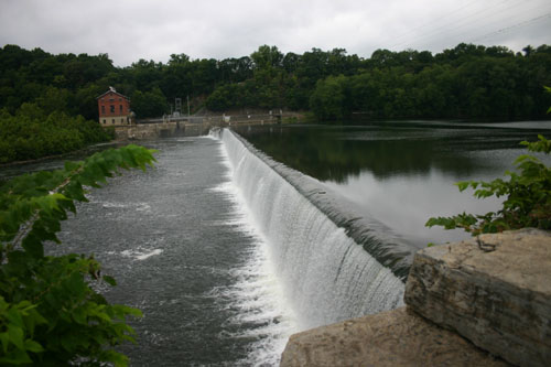
navigable all the way to DC. We soon came to a dam that answered that question.
There are several dams along our trip.
We stopped at an old mill that was at the trail head that
Paul and Jody used as the end of the first SAG of the day. There we ran in Erin
and Mark again. Soon after starting again up we reached a section of the trail
that was closed until this year. This in an area where the canal ran close to the river then got wash away over
time. The trail also got washed away right up to the cliffs now at the river’s
edge. The park service had a concrete ledge constructed to continue the trail.
This was another portion of the trail that made me very nervous.
Bob and Kay had taken the SAG duties before lunch and as we
got to Williamsport they found a Café that we all stopped at for lunch. After
lunch I took my front wheel to the local
bike shop to have the tire
replaced. The guy at the shop told me
that I shouldn’t be using high pressure tires on the trail. He replaced the front tire and I hoped the
rear would hold out for one more day of riding.
After lunch we continued on our ride. Jim and Sonya took the
last Sag section of the day. As the rest of us approached Shepherdstown Paul
and Bob expressed an interest in going to check out Antietam Battle Field which
was only a few miles out of the way. So we climbed out of the river valley and
checked out the National Park. We checked out the displays in the visitor’s
center then rode part of the car tour through the battle field.
After exploring, we rode down the hill into Shepherdstown
and found the Comfort Inn where we would be staying for the night. Jim had
scoped the place out and took us and our bikes to the do-it-yourself car wash
behind the hotel. There we spray washed the mud off our bikes and then unloaded
our luggage and settled in. We found a local Italian restaurant for dinner,
then we went back to the hotel where we played a few rounds of Left Right
Center, a dice game that Bob likes to play. He really liked this round because
Kay won both games.
Day 5 - Shepherdstown to Leesburg | PICS | MAP
In the morning we ate breakfast at the hotel and got ready
for our ride. Back on the trail it didn’t take long to arrive across the river
from Harper’s Ferry. I was initially reluctant to consider crossing the river
to visit the town because there is a spiral staircase to get on the bridge to
get across. Bob and Paul checked out the staircase and decided that we could
get the tandems up to the bridge. So we all worked on getting bikes up the
stairs then walked across to the town.
This was the first sign that I was getting close to home. I had at
one time biked from my home to Harper’s Ferry and back on a club ride some
years ago. The first thing that struck me about the town was how quaint and
picturesque the town was. It was so close to my home and we rarely visit it. We
checked out John Brown’s fortress, some of the shops and the much of the rest
of town. On our way back out we ran into Mark and Erin for what would be out last
encounter with them.
The puddles on the trail after Harper’s Ferry reached a
peak. They were more frequent and deeper than at any other point on the trail.
We next arrived at Brunswick which was our stop for lunch. Jim and Sonya
covered the SAG to that point and found a café in an old converted church named
Beans in the Belfry. We ordered sandwiches and ate at the tables on the
sidewalk outside the Café.
We moved along as Bob and Kay took over the SAG
duties. As
we got started Jim and Sonya were riding with Kathie and I was we got
our third
flat for the trip. With help from Jim we got back on the road, passed
Point of Rocks, then found Whites Ferry. This would be our
transportation into Virginia.
For me, I was home. Getting into Leesburg from the ferry
took me on roads that I frequently ride. I led Jim and Sonya and Paul and Jody
through Leesburg. I even took them on a short section of the W&OD trail
that is my usual trail to ride on. I got everyone to the Comfort Suites Hotel
where Bob and Kay had scoped out how to clean our bikes and the hotel offered a
conference room to store them.
Soon we got our showers and got ready for dinner. At 6:30 we
gathered at the hotel shuttle to get a ride to the Tuscarora Mill Restaurant.
There we had arranged to have five other couples that we all knew from our
Pennywise Tandem Tours.These are the tours in Europe that we have done over the years. This was
a great re-union for us and a great victory dinner for our last night of
touring.
Day 6 - Leesburg to Washington DC | MAP
On the last day we had breakfast at the hotel. Jim and Sonya
decided to catch a rental car a day early and Kathie and I had planned to SAG
the entire day because this was the simple way to get enough vehicles into DC
to get People and Bikes out.
 This left Bob and Kay and Paul and Jody to finish the
C&O Trail. Meanwhile Kathie and I drove home to drop off some luggage and
pick up our Highlander and our friends Dave and Julie to help us meet up with
the others as they ended their ride. We drove three cars to Roosevelt Island on
the Virginia side of the Potomac. Dave and Julie led us over the Key Bridge and
onto the C&O trail where Kathie and I stopped at Fletchers boat house while
Dave and Julie continued up the trail. Soon Paul and Jody and Bob and Kay
arrived with Dave and Julie and we all took the Capital Crescent Trail into
Georgetown.
The other couples told us about seeing Great Falls, which are
beautiful falls on the Potomac and they got to see a working lock in action.
We found an Italian restaurant, il Canal in Georgetown near the end of
the C&O where we had a great lunch and a fitting end to the ride. After
lunch, there was one last ride to cap off the week. I led the others through
the streets of DC, past the White House, the Washington Monument, and the
Jefferson Memorial. We took the 14th Street Bridge over to Virginia
then the Mt. Vernon Trail back to Roosevelt Island.
There we gave the Bore’s their SAG vehicle back with Bob and
Kay’s bike as well as their own. We packed our bike in Dave and Julies Van and Bob
and Kay in our Highlander. We said goodbye to Paul and Jody, then we all drove
back to Reston to further sort out luggage and say our goodbyes. We took Bob
and Kay to their hotel and our weeks trip was complete.